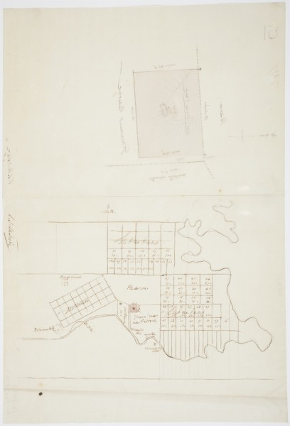
Sketch map of Melbourne by Charles Joseph La Trobe, c.1840
- first
- ‹ previous
- 2363 of 2410
- next ›
- last
This sketch map by Charles Joseph La Trobe marks in pink his own estate known as Jolimont. Directly south, on the river, is the site of the Mounted Police. Further to the east, on the other side of the bend now straightened, is the site of the Native Police. Further to the east again, and on the south side of the river is the Aboriginal Mission Station. Other points of interest are Batman's Hill and the old Burial Ground.
The original is in the collection of the State Library of NSW, details below:-
[Sketch plan and map showing Melbourne and detail of block of land adjacent to Government reserve]
COPYRIGHT AND PERMISSIONS:
This image may be used freely without requesting permission. Please acknowledge that the image is from the collections of the State Library of New South Wales.
CALL NUMBER: D Ca 84/23 [Dixson Map Collection (Z/Ca84/23)]
IE NUMBER: IE3763892
FILE NUMBER: FL3763903
FILE TITLE:
[Sketch plan and map showing Melbourne and detail of block of land adjacent to Government reserve] [cartographic material] / C.J. La Trobe. [Album view] 1840
Search under ‘Charles Joseph La Trobe’ and filter by Maps
Thanks to Marie Fels who located this item.

