Welcome
 Welcome to the East Melbourne Historical Society.
East Melbourne is a tiny suburb adjoining the city of Melbourne bounded by Treasury and Fitzroy Gardens to the west, Victoria Parade to the north, Hoddle Street to the east and Yarra Park to the south, home of the famous Melbourne Cricket Ground. East Melbourne was included in Robert Hoddle's original 1837 plan for the city but the first private house was not built until 1853. The suburb today reflects a history of Victoria with its beautiful gardens, grand houses of the gold rush era and workmen's cottages. Cast iron lacework adorns the houses, bluestone cobbled lanes lead to old coach houses and brick dunnies. Artists, scientists, politicians, judges, educators, priests, explorers, entrepreneurs, courtesans, philanthropists and social activists lived here and many a tale is told of characters wild and exotic.
- Read more
- 28977 reads
Site statistics
Recent articles
More than a Kindergarten
An interesting side-light on the changing demographic of Melbourne in the years after the second world war was the decision to relocate the existing City Free Kindergarten in Exhibition Street (on the corner of Little Lonsdale Street) to Powlett Reserve in East Melbourne.
- Read more
- 530 reads
Jolimont and Repatriation
By 1917 it was apparent that repatriation services for returning service men and women were inadequate. Soldiers were arriving back in the country in large numbers, most of them damaged by illness or injury. Many of them would not be able to return to their pre-war occupations.
- Read more
- 503 reads
The Curious Mr Stanford: from East Melbourne to California
Thomas Welton Stanford arrived in Melbourne in 1860 to make money. He achieved this by quickly securing the sole licence to import Singer sewing machines. But it is not for his business success that he is primarily known.
- Read more
- 1734 reads
Pros and (Mod) Cons
In aid of the Red Cross and War Comforts Funds Melbourne City Council has transformed the Treasury Gardens into a Garden City with an extensive lighting scheme. It will be open on Monday at 1 p.m. for one month, with daily sessions from 10 a.m. to 10 p.m.
- Read more
- 1467 reads
Bedggood: Friendly Footwear
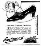
Daniel Bedggood arrived in Melbourne in 1854. Almost immediately he set up a boot and shoe factory in Richmond. A successful business from the start, succeeding generations kept it going and his son, John, oversaw the transition to a new and bigger factory in Jolimont, at 22 Agnes Street, in 1899.
- Read more
- 1457 reads
Forthcoming activities
Recent acquisitions
Victorian History Journal December 2025
Articles on aspects of Victoria's history
This issue focuses on Understanding Victoria. Themes discussed include the 50th Anniversary of the Victorian Heritage Register; colonisation; immigration.
- 134 reads
St Hilda's sold
An article reporting the sale of St Hilda's, 1 Clarendon Street, East Melbourne to Elizabeth Ring, ex-wife of Stephen Ring, a major shareholder in Swisse Vitamins before its sale. Price believed to be in excess of $22 million.
- 419 reads
St Hilda's for sale
An article reporting that the Police Association intends selling its building at 1 Clarendon Street, East Melbourne.
- 406 reads
Marlion House sold
Article reporting that the Krongold family has sold its offices at Marlion House, 33-41 Agnes Street, East Melbourne (Jolimont). The price is given at around $25 million. Originally the building was a warehouse belonging to Griffiths Bros, tea merchants, and was later used by the Herald and Weekly Times, it was converted to offices in 1988.
- 354 reads
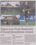
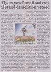
Richmond Football Club vows to exit Punt Road Oval if Jack Dyer Stand can't be demolished
Article about Richmond Football Club's proposal to redevelop its ground to create a larger playing area, comparable to that of the MCG. This will necessitate the demolition of the Jack Dyer Stand, which will be replaced with a stand of twice the capacity. The club claims that there is no other way to achieve its aims and if demolition is refused it will be forced to leave
- 398 reads


