Home

East Melbourne Historical Society

Drop-down menu

  • Articles
  • People
    • Notable Women
    • WW1 soldiers and nurses
    • WW1 nurses
  • History
    • Milestones
    • Buildings
    • Community
    • People
  • Gallery
    • Maps
    • MMBW plans
    • Abortion battles
    • Bishopscourt
    • Bishopscourt garden
    • Bomb shelter
    • Buildings
    • Cairns Memorial Church
    • Early Melbourne
    • Football
    • Jean Campbell
    • Lanes
    • Margaret McLean
      • Family and home
      • Female suffrage
      • Clippings - Australia
      • Clippings - Britain
      • Clippings - USA
    • Personalities
    • Yarra Park
      • History
      • Desecration
    • Yarra River
  • Catalogue
    • Browse and Search
    • Catalogue table view
    • Site images
  • Images
  • Society
    • Activities
    • Newsletters
    • Tributes
      • John Barrie Wykes
      • Wynne McGrath
    • Publications
    • About
Home
    • Home
    • Search
    • Forum
    • Contact

Maps

1837 Town of Melbourne

1837 Town of Melbourne
  • Login or register to post comments
  • 16753 reads

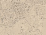
1864 (revised 1875) East Melbourne Map

1864 (revised 1875) East Melbourne Map

Extract of East Melbourne from British Admiralty Chart "Map of Hobson Bay and Yarra River leading to Melbourne" surveyed in 1864, first published 1865. This version has annotations dated 1875.

Acknowledgments: 

State Library of Victoria

  • Login or register to post comments
  • Read more
  • 23173 reads

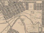
1864c East Melbourne Map

1864c East Melbourne Map
  • Login or register to post comments
  • 19260 reads

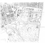
1865c East Melbourne Map

1865c East Melbourne Map
  • Login or register to post comments
  • 15907 reads

1866 Isometrical plan of Melbourne & suburbs

1866 Isometrical plan of Melbourne & suburbs

Shows the layout of Melbourne streets circa 1866 with buildings, the Yarra, Port Phillip Bay in distance, parts of Collingwood and East Melbourne.

Acknowledgments: 

State Library of Victoria
Creator: De Gruchy & Leigh, lithographer.
Title: Isometrical plan of Melbourne & suburbs, 1866 [picture]
Accession number(s): H291
Date(s) of creation: 1866.
Medium: 1 print : lithograph with hand colouring ;
Dimensions: 59 x 93 cm., in frame 83 x 113 cm.
Contents/Summary: Shows the layout of Melbourne streets with buildings, the Yarra, Port Phillip Bay in distance, parts of Collingwood and East Melbourne.
Notes:
   Frame: wood.
   Black and white photographic copies H23932, H29613.
   Title and date from plaque on frame l.c.
   Lithographers name on plaque on frame: DE GRUCHY & LEIGH
   Key to plan at H6091.
Subject(s):
   Melbourne (Vic.) -- Pictorial works.
   Bird’s-eye view prints.
   Lithographs.
Location: Picture
Call number: PIC LT 1017
Number of items: 1
Volume/Item: SCR 75A S E WING
Notes: A400

  • Login or register to post comments
  • 25687 reads

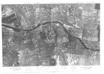
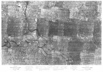
1945 Aerial Photo - Melbourne

1945 Aerial Photo - Melbourne

State Library of Victoria

  • Login or register to post comments
  • 22851 reads

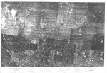
1945 Aerial Photo - Melbourne East

1945 Aerial Photo - Melbourne East

State Library of Victoria

  • Login or register to post comments
  • 15264 reads

1945 Aerial Photo - Melbourne North

1945 Aerial Photo - Melbourne North
Acknowledgments: 

State Library of Victoria

  • Login or register to post comments
  • 16673 reads

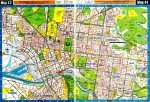
1966 Melway Maps 043, 044

1966 Melway Maps 043, 044
Acknowledgments: 

Maps Collection, State Library of Victoria

  • Login or register to post comments
  • 21631 reads

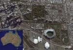
2007 07 East Melbourne Google Earth

2007 07 East Melbourne Google Earth
  • Login or register to post comments
  • 19668 reads
  • 1
  • 2
  • next ›
  • last »
more

User login

  • Join EMHS
  • Request new password
  • Privacy
  • Membership
  • About
  • Contact
  • Guidelines