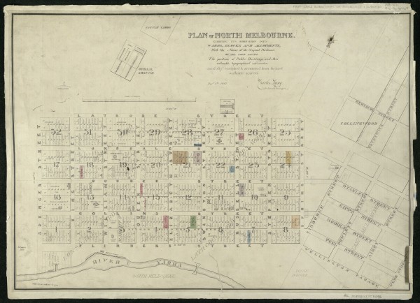
1847 Plan of North Melbourne by Charles Laing
- first
- ‹ previous
- 2046 of 2410
- next ›
- last
The map shows the city of Melbourne with names of orginal purchasers marked. Public buildings are also marked. The western edge of the proposed East Melbourne is shown with streets marked with a set of names very different from the eventual names used.
The map is in the collection of the State Library of Victoria and its citation is below:
Plan of North Melbourne : exhibiting its subdivision into wards, blocks and allotments, with the names of the original purchasers of all sold lands, the position of public buildings and other valuable topographical information / carefully compiled & arranged from the most authentic sources, Decr. 8th, 1847 by Charles Laing, architect & surveyor.
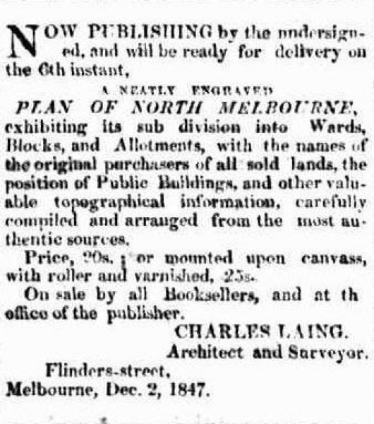
An advertisement from Port Phillip Gazette and Settlers Journal 25 Dec 1847, p.3 shows that the plan was available for purchase.


