Home

East Melbourne Historical Society

Drop-down menu

  • Articles
  • People
    • Notable Women
    • WW1 soldiers and nurses
    • WW1 nurses
  • History
    • Milestones
    • Buildings
    • Community
    • People
  • Gallery
    • Maps
    • MMBW plans
    • Abortion battles
    • Bishopscourt
    • Bishopscourt garden
    • Bomb shelter
    • Buildings
    • Cairns Memorial Church
    • Early Melbourne
    • Football
    • Jean Campbell
    • Lanes
    • Margaret McLean
      • Family and home
      • Female suffrage
      • Clippings - Australia
      • Clippings - Britain
      • Clippings - USA
    • Personalities
    • Yarra Park
      • History
      • Desecration
    • Yarra River
  • Catalogue
    • Browse and Search
    • Catalogue table view
    • Site images
  • Images
  • Society
    • Activities
    • Newsletters
    • Tributes
      • John Barrie Wykes
      • Wynne McGrath
    • Publications
      • Heritage Matters
      • What's in a Name
    • About
Home
    • Home
    • Search
    • Forum
    • Contact

Map of East Melbourne 1864-1879

Subjects

  • Maps
  • first
  • ‹ previous
  • 817 of 2366
  • next ›
  • last
Image
Move your mouse over image or click to enlarge
Image
Move your mouse over image or click to enlarge
Acquisition number: 
769
Catalogue number: 
empf0020
File name: 
pf0020
File location: 
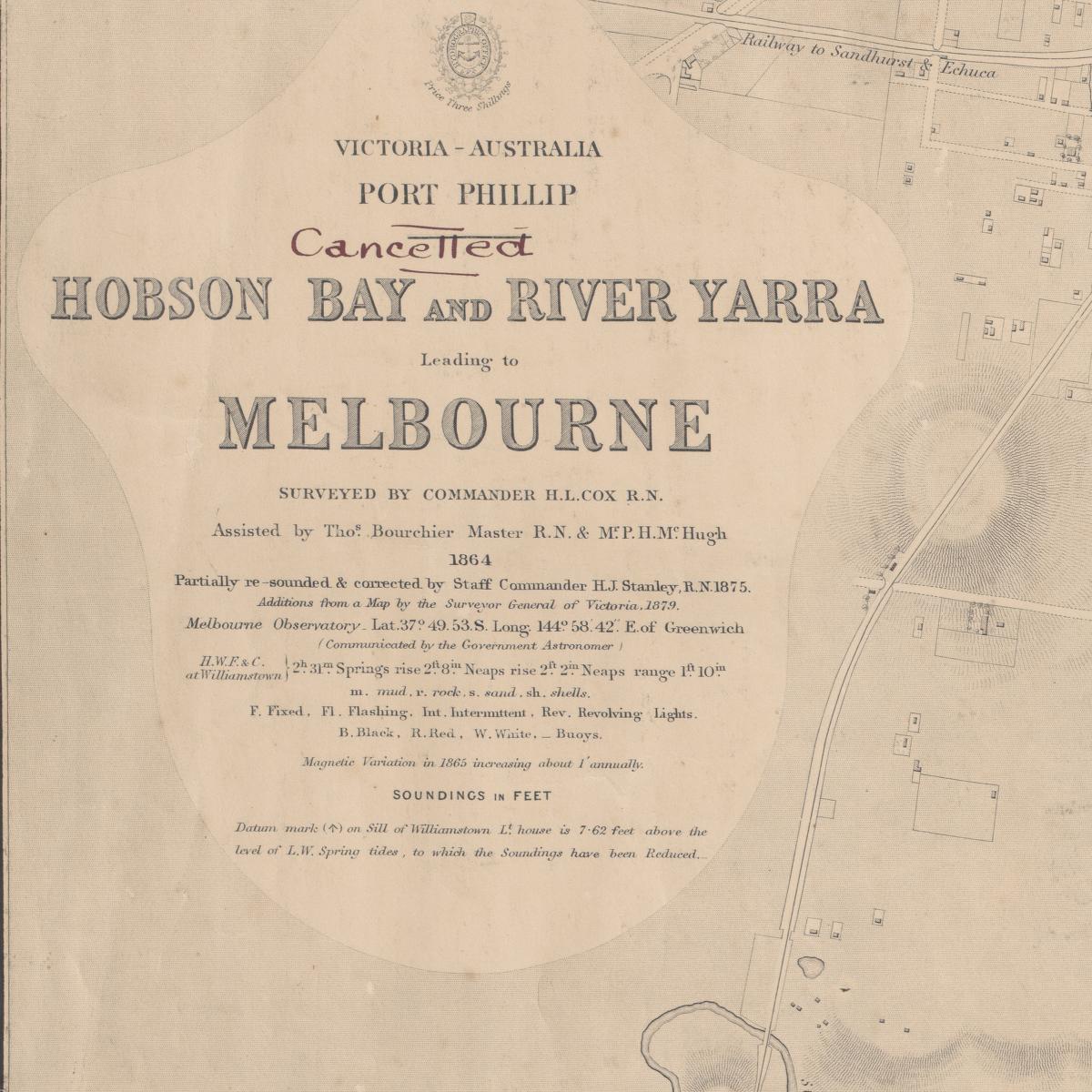
Plan file

Partial print of the so called "Cox Chart" 1864. "Hobson Bay and River Yarra Leading to Melbourne" by Commander H.L. Cox R.N. 1864 with updates in 1875 and 1879.

Item type: 
Map
Item size: 
56x42 cm
Item condition: 
Fair copy
Artist-illustrator: 
H.L. Cox
Date of publication or creation: 
1864
Reproduction rights: 
National Library of Australia
Date digitised: 
2010-02-26
  • 7799 reads
  • Share this
  • PrintPrint
  • EmailEmail

User login

  • Join EMHS
  • Request new password
  • Privacy
  • Membership
  • About
  • Contact
  • Guidelines