Home

East Melbourne Historical Society

Drop-down menu

  • Articles
  • People
    • Notable Women
    • WW1 soldiers and nurses
    • WW1 nurses
  • History
    • Milestones
    • Buildings
    • Community
    • People
  • Gallery
    • Maps
    • MMBW plans
    • Abortion battles
    • Bishopscourt
    • Bishopscourt garden
    • Bomb shelter
    • Buildings
    • Cairns Memorial Church
    • Early Melbourne
    • Football
    • Jean Campbell
    • Lanes
    • Margaret McLean
      • Family and home
      • Female suffrage
      • Clippings - Australia
      • Clippings - Britain
      • Clippings - USA
    • Personalities
    • Yarra Park
      • History
      • Desecration
    • Yarra River
  • Catalogue
    • Browse and Search
    • Catalogue table view
    • Site images
  • Images
  • Society
    • Activities
    • Newsletters
    • Tributes
      • John Barrie Wykes
      • Wynne McGrath
    • Publications
      • Heritage Matters
      • What's in a Name
    • About
Home
    • Home
    • Search
    • Forum
    • Contact

1972 East Melbourne Aerial Photo

East Melbourne

  • first
  • ‹ previous
  • 1295 of 2366
  • next ›
  • last
Image
Move your mouse over image or click to enlarge
Acquisition number: 
810
Catalogue number: 
eml0001
File name: 
EML0001
File location: 
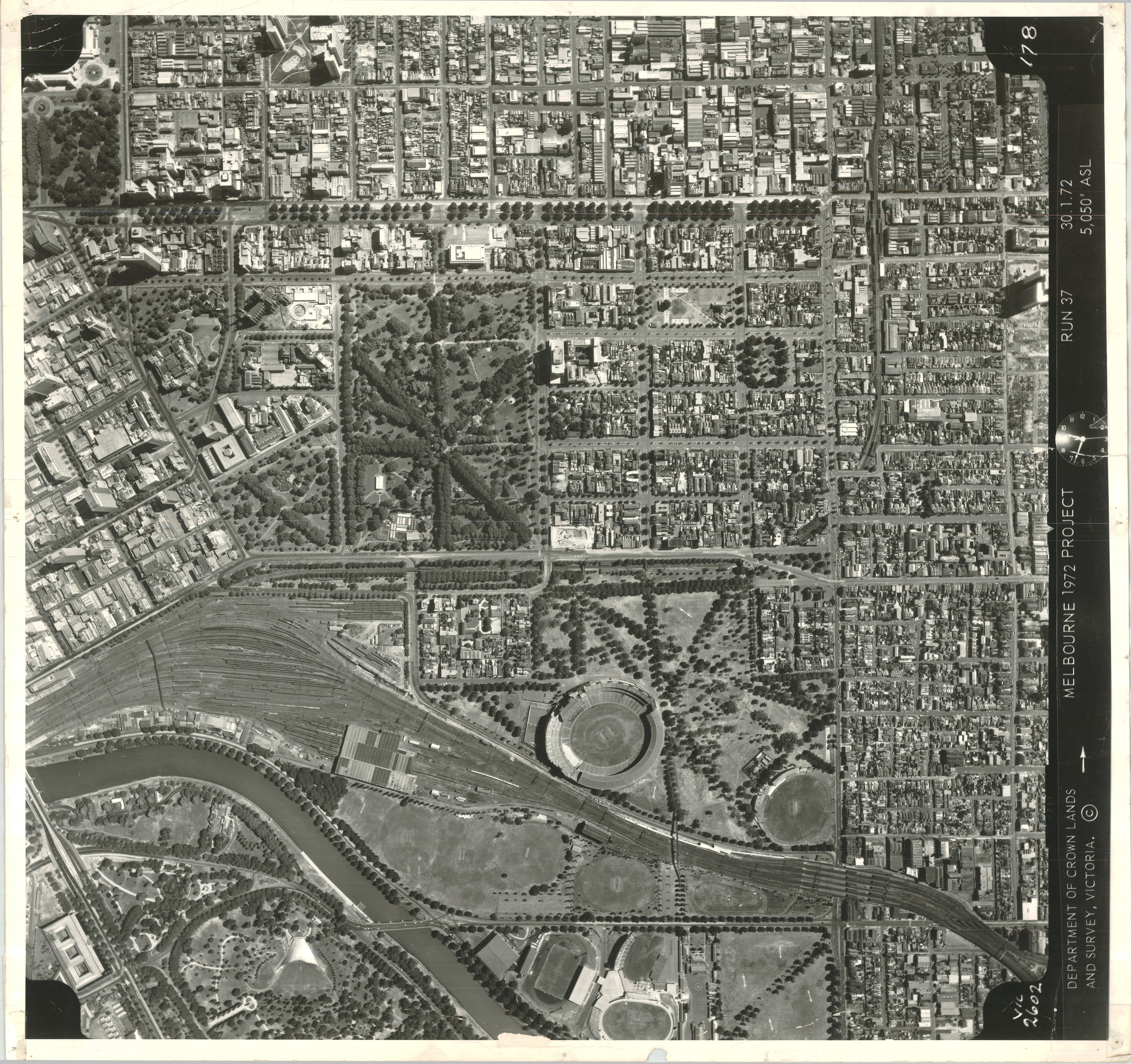
East Melbourne Library

Aerial photograph of East Melbourne taken at 12:48pm on 30 January 1972 from an altitude of 5,050 feet above sea level. Run 37.
Centre of map approx corner of Wellington Parade and Clarendon Street.
Central coverage:
East Melbourne, Jolimont, Fitzroy and Treasury Gardens, Yarra Park, MCG, Jolimont Railway Yards.
Limits of coverage clockwise from north west:
Gertrude Street, Fitzroy
Gipps Street, Collingwood
Lennox Street, Richmond
Gosh's Paddock (part)
Yarra River
Queen Victoria Gardens
St Kilda Road north to Princes Bridge
Flinders Street East, Melbourne
Spring Street, Melbourne
Nicholson Street, Carlton

Item type: 
Aerial view
Item size: 
42x37 cm
Item condition: 
Good
Publisher: 
Department of Crown Lands and Survey Victoria
Publication place: 
Melbourne, Victoria
History of item: 

Part of "Melbourne 1972 Project" - an aerial survey of metropolitan Melbourne.

Date digitised: 
2010-05-26
Location map:
Javascript is required to view this map.
  • 7103 reads
  • Share this
  • PrintPrint
  • EmailEmail

User login

  • Join EMHS
  • Request new password
  • Privacy
  • Membership
  • About
  • Contact
  • Guidelines