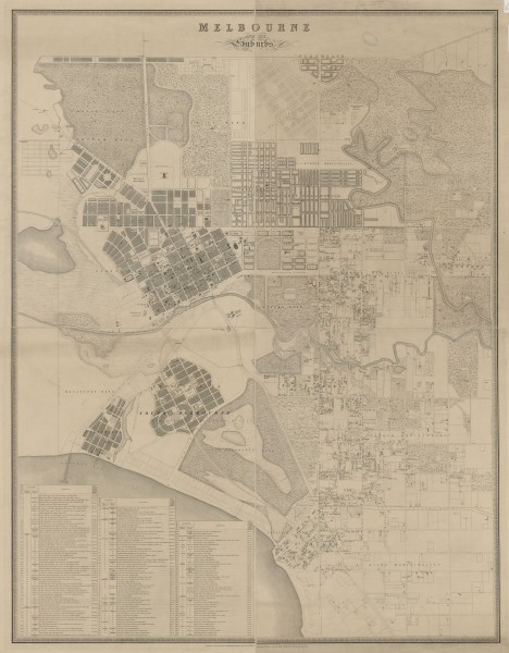
Map of Melbourne and its Suburbs - 1855
- first
- ‹ previous
- 1341 of 2410
- next ›
- last
Detailed map of Melbourne and suburbs in 1855. It extends from Northcote in the north to St Kilda in the south and from North and South Melbourne in the west to Studley Park in the east.
Compiled by James Kearney, Draughtsman. Engraved by David Tulloch and James D. Brown. Captain Andrew Clarke R.E., Surveyor General. 1855
Obtained from the State Library of Victoria where it is in the form of one map on four sheets each mounted on heavy card. The image shown here has been compiled from four digital images published by the State Library of Victoria.
SLV Citation:
Brown, J. D., Kearney, J., & Tulloch, D. (1855). Melbourne and its suburbs [cartographic material] / compiled by James Kearney, draughtsman ; engraved by David Tulloch and James D. Brown. [Melbourne]: Andrew Clarke, Surveyor General.

