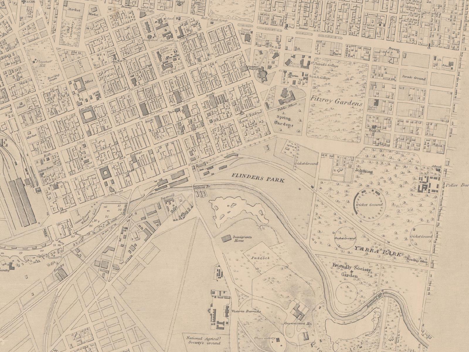
Home

East Melbourne Historical Society

Drop-down menu

  • History
    • Milestones
    • Buildings
    • Community
    • People
  • Gallery
    • Maps
    • MMBW plans
    • Abortion battles
    • Bishopscourt
    • Bishopscourt garden
    • Bomb shelter
    • Buildings
    • Cairns Memorial Church
    • Early Melbourne
    • Football
    • Jean Campbell
    • Lanes
    • Margaret McLean
      • Family and home
      • Female suffrage
      • Clippings - Australia
      • Clippings - Britain
      • Clippings - USA
    • People
    • Yarra Park
      • History
      • Desecration
    • Yarra River
  • Catalogue
    • Browse and Search
    • Catalogue table view
  • Society
    • Activities
    • News archive
    • Newsletters
    • Publications
    • About
Home Image Galleries Maps
    • Home
    • Forum
    • Contact

1864 East Melbourne Map

  • first
  • ‹ previous
  • 2 of 14
  • next ›
  • last
1864 East Melbourne Map

Extract of East Melbourne from British Admiralty Chart "Map of Hobson Bay and Yarra River leading to Melbourne" surveyed in 1864, first published 1865. This version has annotations dated 1875. See full chart under EMHS catalogue item emdf0041. 

Acknowledgments: 

State Library of Victoria

  • first
  • ‹ previous
  • 2 of 14
  • next ›
  • last
  • Login or register to post comments
  • 2571 reads
  • Share this
  • Thumbnail
  • Illustration
  • PrintPrint
  • EmailEmail

User login

  • Apply for membership
  • Request new password
  • Privacy
  • Membership
  • About
  • Contact
  • Guidelines